30 Day Map Challenge 2026
Day 1: Points
Day 1 of the #30daymapchallenge is Points. Here is a map of mass balance measurements done across the Himalaya in India, Nepal and Bhutan. Dr Mohd Farooq Azam at ICIMOD compiled the data for a paper published in the Journal of Glaciology earlier this year. The paper called for recommendations to the glacial community to strengthen mass balance estimates through more robust and standardised random-error estimation, reanalysing glaciers where monitoring has spanned 10+ years, expanding monitoring in underexplored areas, and long-term continuous monitoring of benchmark glaciers. The data show 17 monitoring efforts that were discontinued and 21 that are currently ongoing or have been restarted. Of these, Stok Kangri was said to be discontinued, although I have colleagues who are continuing monitoring efforts there. I am sure there may be new glaciers currently being monitored or missed by this study.
The plan for this mapping series is not to use AI at all in the process, from data acquisition to processing, and not to get bogged down trying to make the perfect map. A challenge is coming up that says “prompting only”, but I will do something different for that. This map uses mass balance data from Azam (2026), the Himalayan boundary layer from Liu et al. (2022), and an ESRI basemap. The map was compiled in Photoshop.
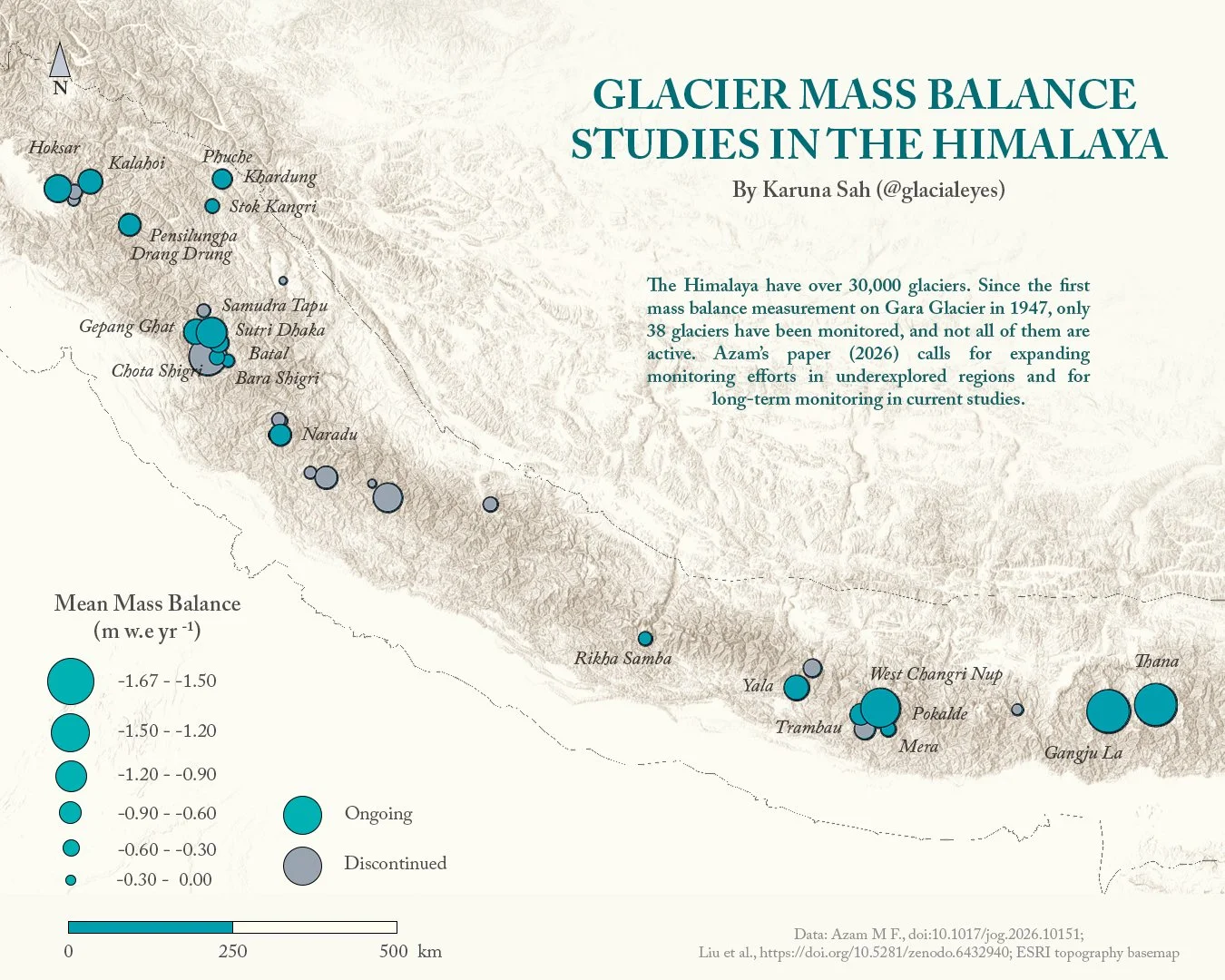
Ongoing and discontinued glacier mass balance studies in the Himalaya
Day 2: Lines
Day 2 of the #30daymapchallenge is Lines. While thinking of interesting topics for lines, I initially thought of the longest connected network of roads one can walk on - there are several Reddit posts on this. One long line sounded more appealing to map. Instead, I stumbled upon an expedition called Goliath (appropriately named!), a 28-year-long journey of Karl Bushby, an ex-paratrooper from Kingston upon Hull, England. He was in Punta Arenas, Chile, and on November 1st 1998, he decided to walk home. His website details his journey across the Atacama Desert, through the swamps and jungles of the Darién Gap, across the Bering Strait, swimming across the Caspian Sea, navigating geopolitics, navigating the pandemic and all the side hustles along the way! I read that he is finally home TODAY November 2nd, 2026!! I feel the map was meant to be.
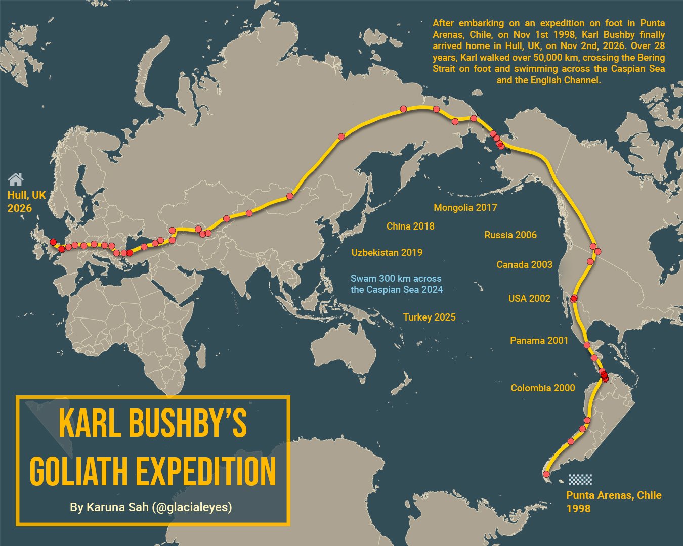
Map of Karl Bushby’s Goliath Expedition